14th April 2016
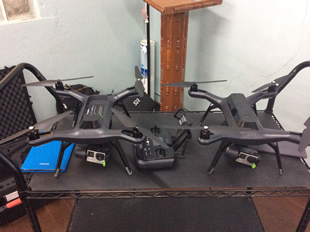 |
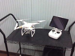
With the recent acquisition of state of the art Drones, the Environment Department, the Fisheries Division, the Development Control Authority, the Environment Awareness Group and the Survey Department are now in possession of the latest technology to carry out their site monitoring, mapping and data collection initiatives.
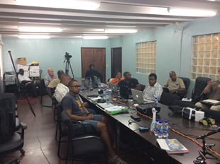
The announcement was made during a two-day workshop at the Environment Division today (Thursday) where three experts in the field of drone technology conducted and launched the much anticipated Drone for Conservation initiative.
 |
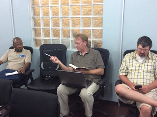
Among the facilitators were George Raber and Steve Schill from the Nature Conservancy and Dr. Kim Baldwin from the University of the West Indies Cave-Hill Campus in Barbados.
During her half hour discourse, Dr. Baldwin explained that one of the objectives of the initiative is to compare advantages and disadvantages of both the Drone technology and Satellite imagery.
She is of the view that Drones and the features that they bring are a step in the right direction where data collection is concerned.
 |
"One of the main objectives of this project is to look at the pros and cons of Satellite imagery versus drone mapping because they both have different applications but drones are much better on a smaller level. Drones can be ten times more accurate than using satellite imagery and at a fraction of the cost because to collect satellite imagery of a country can cost up to half a million US dollars while all of the technology we have here for the environment department is less than ten thousand US", Baldwin said.
Dr. Baldwin explained that another major benefit from drones is that the results can be obtained immediately rather than having to wait weeks for satellite data.
"We can have real time data with drones as oppose to waiting months. It use to take six months to a year to collect, process and use data from Satellite imagery but on the negative side now, drones function on a smaller scale and are limited by battery life so there are pros and cons", she stated.
 |
On another point, the official noted that with the new resources, data collected from five years ago will be compared and analyzed with information that will be collected this week to see if any damage and erosion had occurred during that period.
"We will be using the Cades Bay and Johnson's Point area as our demonstration site because back in 2011, we mapped the reefs and coastal mangrove areas and we are going to use the drones in 2016 to map out the same areas and see what damages have been done for the past five years", Baldwin concluded.
With the new technology in hand, the Environment Division, the EAG, DCA, Fisheries and the Survey Department are now better equipped to handle terrestrial and marine mapping, elevation and hydrological flow models, mangrove threats, clearing and mapping as well as development monitoring and evidence gathering.
The new equipment will also aid in the sea turtle and sea bird nesting monitoring, post disaster assessment and mitigation efforts, national parks and boundary monitoring, illegal fishing as well as heritage sites and mapping for tourism purposes.
The workshop will conclude on Friday.
For More Information Contact:
Debbie Francis
Tel: (268) 464-8026